UQ St Lucia Dataset: a 9.5km stereo vehicular dataset with INS
#
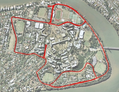
The UQ St Lucia Dataset is a vision dataset gathered from a car driven in a 9.5km circuit around the University of Queensland’s St Lucia campus on 15/12/10. The data consists of visual data from a calibrated stereo pair, translation and orientation information as a ground truth from an XSens Mti-g INS/GPS and additional information from a USB NMEA GPS. The dataset traverses local roads and encounters a number of varying scenarios including roadworks, speed bumps, bright scenes, dark scenes, reverse traverses, a number of loop closure events, multi-lane roads, roundabouts and speeds of up to 60 km/h.
Kagaru Dataset: a 6.5km stereo airborne dataset with INS
#
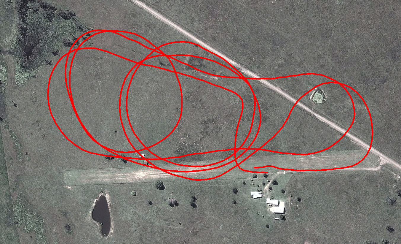
The Kagaru Airborne Dataset is a vision dataset gathered from a radio-controlled aircraft flown at Kagaru, Queensland, Australia on 31/08/10. The data consists of visual data from a pair of downward facing cameras, translation and orientation information as a ground truth from an XSens Mti-g INS/GPS and additional information from a USB NMEA GPS. The dataset traverses over farmland and includes views of grass, an air-strip, roads, trees, ponds, parked aircraft and buildings.
See the dedicated web page for more info: Kagaru Dataset.